
Middlesex COUNTY · Coast & maritime life
Old Saybrook’s working lights
Lynde Point and the outer breakwater light at the mouth of the Connecticut River.
Historical focus · 1886–1999
LOOK CLOSER · OPEN ANY IMAGE
The story in photographs
1972
Photo copy of historic photograph, 1972, VIEW LOOKING NORTH, SHOWING ORIGINAL AWNING AT BASE OF LIGHTHOUSE. U.S.…
Photo copy of historic photograph, 1972, VIEW LOOKING NORTH, SHOWING ORIGINAL AWNING AT BASE OF LIGHTHOUSE. U.S. Coast Guard Civil Engineering Unit, Warwick, RI - Saybrook Breakwater Light, South tip of west end of Saybrook Breakwater, Old Saybrook, Middlesex County, CT
Image credit & source
Creator not identified / Historic American Buildings Survey–Historic American Engineering Record, Library of Congress
No known restrictions on images made by the U.S. Government; images copied from other sources may be restricted.
Original source · Reuse termsPhotograph date not recorded
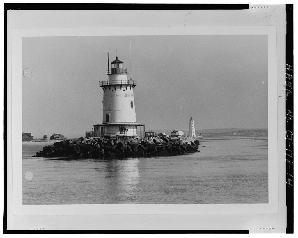
View looking northeast, showing Saybrook east breakwater in the right background - Saybrook Breakwater Light, South…
View looking northeast, showing Saybrook east breakwater in the right background - Saybrook Breakwater Light, South tip of west end of Saybrook Breakwater, Old Saybrook, Middlesex County, CT
Image credit & source
Creator not identified / Historic American Buildings Survey–Historic American Engineering Record, Library of Congress
No known restrictions on images made by the U.S. Government; images copied from other sources may be restricted.
Original source · Reuse termsPhotograph date not recorded
View looking northeast, with Saybrook east breakwater in the background - Saybrook Breakwater Light, South tip of…
View looking northeast, with Saybrook east breakwater in the background - Saybrook Breakwater Light, South tip of west end of Saybrook Breakwater, Old Saybrook, Middlesex County, CT
Image credit & source
Creator not identified / Historic American Buildings Survey–Historic American Engineering Record, Library of Congress
No known restrictions on images made by the U.S. Government; images copied from other sources may be restricted.
Original source · Reuse termsPhotograph date not recorded
View looking northwest, showing Saybrook west breakwater and Lynde Point Lighthouse in the right background -…
View looking northwest, showing Saybrook west breakwater and Lynde Point Lighthouse in the right background - Saybrook Breakwater Light, South tip of west end of Saybrook Breakwater, Old Saybrook, Middlesex County, CT
Image credit & source
Creator not identified / Historic American Buildings Survey–Historic American Engineering Record, Library of Congress
No known restrictions on images made by the U.S. Government; images copied from other sources may be restricted.
Original source · Reuse termsPhotograph date not recorded
View looking southeast - Saybrook Breakwater Light, South tip of west end of Saybrook Breakwater, Old Saybrook,…
View looking southeast - Saybrook Breakwater Light, South tip of west end of Saybrook Breakwater, Old Saybrook, Middlesex County, CT
Image credit & source
Creator not identified / Historic American Buildings Survey–Historic American Engineering Record, Library of Congress
No known restrictions on images made by the U.S. Government; images copied from other sources may be restricted.
Original source · Reuse termsPhotograph date not recorded
View looking southwest - Saybrook Breakwater Light, South tip of west end of Saybrook Breakwater, Old Saybrook,…
View looking southwest - Saybrook Breakwater Light, South tip of west end of Saybrook Breakwater, Old Saybrook, Middlesex County, CT
Image credit & source
Creator not identified / Historic American Buildings Survey–Historic American Engineering Record, Library of Congress
No known restrictions on images made by the U.S. Government; images copied from other sources may be restricted.
Original source · Reuse termsTHE STORY BEHIND THE PHOTOGRAPHS
People, places, and change.
An outer light, 1886
Saybrook Breakwater Light was established in 1886 at the west jetty’s end, about a mile and a half from Lynde Point Light. Cast iron and brick lining formed its tower, supported by a caisson foundation. [1]
Light and sound
The station combined a Fresnel lens with a fog signal. A fourth-order lens replaced the original in 1890. The National Archives preserves Saybrook logbooks covering 1918 into 1934, a source for studying the work behind the familiar landmark. [1] [2]
Storm and automation
The September 21, 1938 hurricane tore away the station’s bridge, platform, boat and kerosene tank, but its keeper maintained the light. Automation followed in 1959. Images here include a 1972 Coast Guard photograph and documentary views with unrecorded dates. [1]
Sources & further reading (2)
Keep the sources close.
Download this collection’s notes, timeline and image credits. Photographs link to their original archives and require an internet connection.
Building dates and photograph dates are recorded separately. Later photographs are identified in their captions; unknown exposure dates remain unknown. Follow each image’s credit and reuse terms.