Read the full story of Documented Tunnels of the New Haven Region
COLLECTION HISTORY
The people behind the place.
This collection distinguishes several structures rather than presenting a single underground network. East Haven’s railroad tunnel, the West Rock road tunnel, the former canal-railroad corridor and a hospital service connection had different purposes and locations. A photograph or construction date belongs to the structure identified by its source. East Haven is not West Haven, and a shared regional name does not connect unrelated tunnels. [ED086-S01] [ED086-S02] [ED086-S05] [ED086-S06]
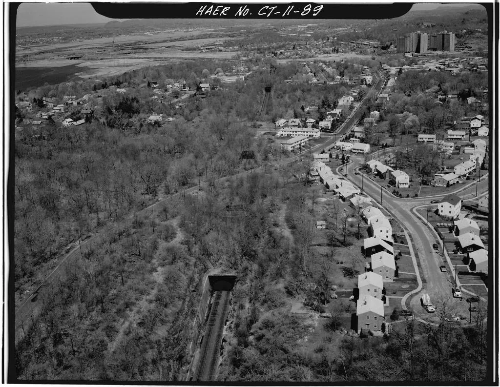
Amtrak’s 2020–2024 infrastructure plan describes East Haven Tunnel as a two-track brick-lined structure, 1,179 feet long, built in 1893. Jack E. Boucher’s 1977 HAER photograph supplies a dated exterior record. The survey uses milepost 77.00 while Amtrak’s inventory uses 76.64; those identifiers remain attributed to their respective records. The plan’s date is used for the documented asset without claiming to resolve every earlier tunnel history at the site. [ED086-S01] [ED086-S02]
The road tunnel through West Rock opened in 1949 with two tubes of approximately 1,200 feet. It is now Heroes Tunnel. The naming evidence needs care: the 2003 act designated “Hero’s Tunnel,” and the 2004 act corrected the spelling to “Heroes Tunnel.” A current CTDOT page instead gives 2001; the archive uses the legislative sequence and retains that discrepancy. Andrew Ciscel’s photograph records the structure in 2007, not at its 1949 opening. [ED086-S03] [ED086-S04]
New Haven’s 2004 greenway plan describes the former railroad alignment beneath Orange and Grove, an open cut toward Whitney Avenue and an approximately 200-foot tunnel between Whitney and Temple under later housing. Those descriptions document transport infrastructure at that planning date. Later city project information describes subsequent trail work, so the 2004 condition is not presented as current access guidance. [ED086-S05]
The 1899 hospital report separately identifies an underground connection between Bronson Ward and the maternity ward. It is evidence of a particular institutional service link, not of a secret citywide system. Plans, captioned photographs and official inventories make these histories teachable because they attach claims to identifiable structures. Stories that lack a location, date or documentary source remain unverified rather than being illustrated with an unrelated tunnel photograph. [ED086-S06]
ESTABLISHEDRail, road and service connections
EARLIEST HISTORYRail, road and service connections
Dates distinguish founding, building opening and later changes; see the chronology below.
About this research edition. A collection of documented history, dated images and original record links. Photographs available only at their publishers are labeled separately from locally included images. Unknown dates and conflicting accounts remain visible.